
What’s in a Name: How The Beaten Path Got Its Nickname
For generations, we knew it simply as “going over the top.” For the last 30 years, the 26-mile journey from East Rosebud Lake to the Clark’s Fork Trailhead near Cooke City, which winds through a striking canyon dotted by emerald lakes, rushing creeks, and tumbling waterfalls, has become known by a single, evocative moniker: The Beaten Path.
A Pejorative Name for a Superlative Place
This name, first coined by Bill Schneider in the 1996 edition of his hiking guidebook to the Absaroka-Beartooth Wilderness, has achieved a level of fame—or infamy—that transcends the nomenclature of traditional maps. To the hiking blogosphere, it is a bucket-list achievement; to the Forest Service, it is Trail #15 (on the Beartooth District side) and Trail #3 (on the Gardiner District side); and to some locals, The Beaten Path name itself feels like a pejorative, a subtle jab at a landscape so beautiful it has been "beaten" by the very people who love it.
But names are more than just cursory labels; they carry the weight of our history, our culture, and even our stewardship. When I spoke with Bill Schneider recently, he admitted the term “The Beaten Path” was meant to be slightly discouraging, an attempt to nudge hikers away from the already-popular trail toward the many other trails, or even the hundreds of miles of off-trail solitude, that the Beartooths offer. Yet, its popularity endured despite, or perhaps because of, the nickname. Even so, it’s a misnomer; the East Rosebud to Cooke City trail is far from a mere "beaten" track. It is a masterpiece of geological and human resilience.
“The Single Most Beautiful Canyon in the World”
My own realization of this canyon's world-class stature came in 1999. I had just returned to Montana after a decade living in Alberta. In the year prior, I had stood on the granite spires of Fitzroy in Patagonia, navigated the ice fields of Mount Logan in the Yukon, and looked out from the summits of Mont Blanc in the Alps and Mount Robson in the Canadian Rockies. I had seen the fjords of Newfoundland and the highest peaks of the Americas. In my first summer after moving back home, I hiked from East Rosebud Lake to Dewey Lake and back in a single day. Throughout the day, despite having seen it all many times in my youth, I was amazed at the continuous whitewater cascade that is East Rosebud Creek, plunging from one azure gem to the next every few miles. As the alpenglow hit the walls of Yosemite-scale monuments near Elk Lake, I recognized something I had taken for granted during my first few decades of life growing up in the canyon: the East Rosebud is the single most beautiful canyon in the world. As Schneider famously noted, it is "better" than most national parks. So, when the route shows up on internet Top 10 lists and dominates social feeds in a way that puts stars in the eyes of bucket-listers and hiking influencers—I get it.
What The Floods Wrought
The last three years have tested that social media-fueled compulsion to show off that you did it. The floods of June, 2022, were a roaring hydrologic reset for the area. High waters wiped out over two miles of road, 4.5 miles of trail, plus the pivotal bridge at Rimrock Lake, rendering much of the hike inaccessible—or at least, highly dangerous to attempt. In the intervening years, the canyon has been a place of mourning, as two young men lost their lives trying to cross at the outlet without the bridge. As of October 2025—40 months after the flood—the bridge has finally been replaced and the trail is fully restored.
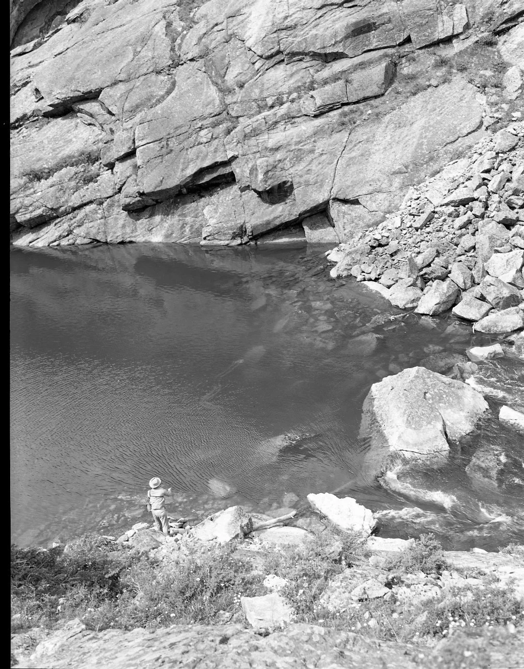
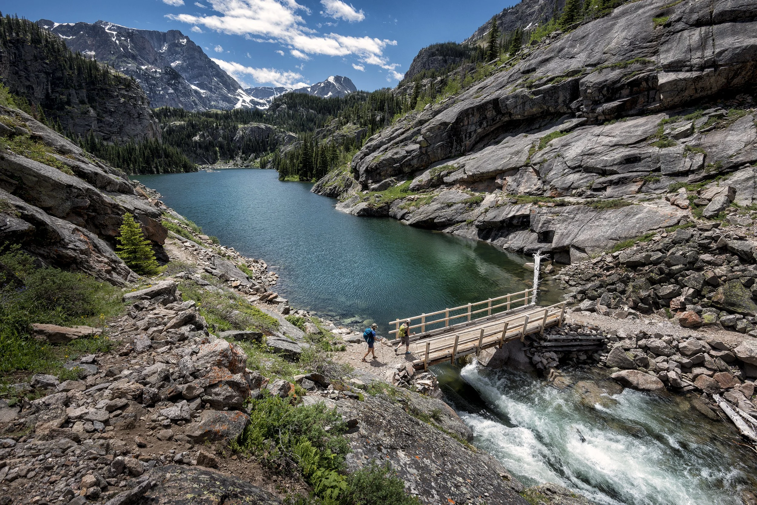
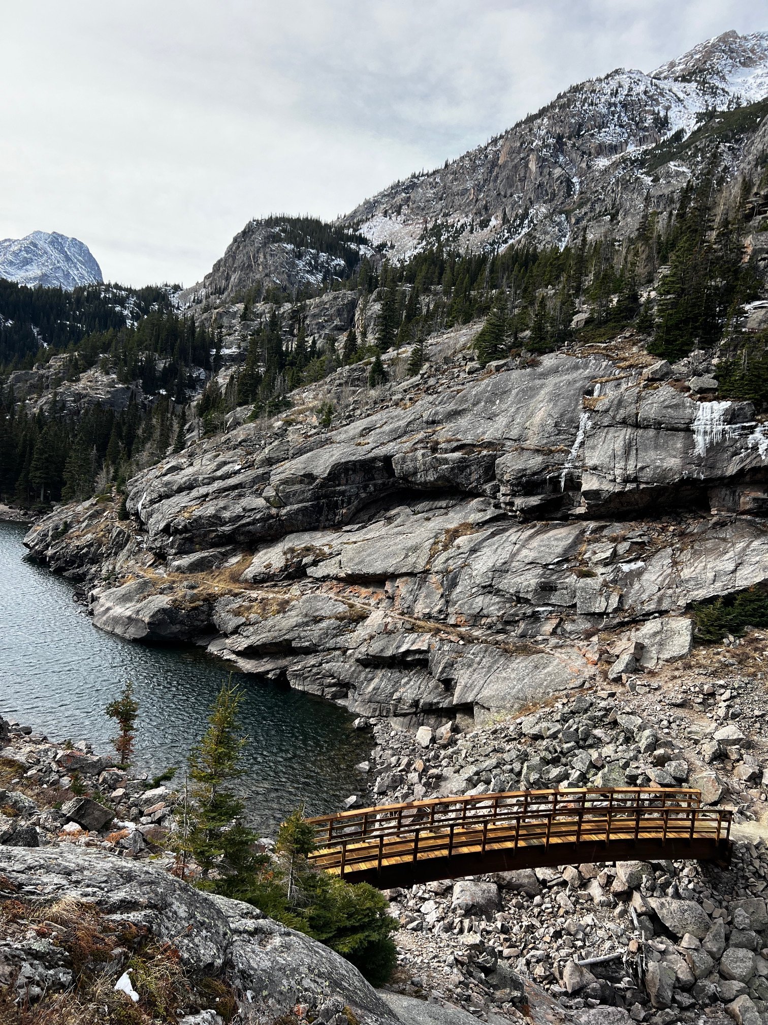
Image 1: Before the bridge; Joe Josephson fishing Rimrock Lake circa mid-1950s
Image 2: The classic David Wells image of the old bridge, pre-floods.
Image 3: The new bridge, as of November 2025
This summer will show just what 40 months of pent-up desire to hike the trail will bring. I suspect the literal floods of 2022 will be followed with a figurative flood of hikers in 2026. We anticipate a record-breaking season that will put the wilderness through a considerable stress test.
Looking Back; Looking Ahead
With so much attention on The Beaten Path, ABWF is launching an episodic blog series exploring the history of this iconic path, starting with this one, so that anyone seeking to hike the path can start from a place of better understanding about the trail’s history and its role in the greater Absaroka-Beartooth Wilderness. In this series, we will dive into the pre-1960s "primitive" era, the Herculean trail-building efforts of 1966-69, the 1978 Wilderness designation, and the decade-long battle for Wild & Scenic status.
Centering Stewardship
Concurrently, and perhaps more importantly, we are introducing an expanded Trailhead Ambassador program this summer to bring face-to-face wilderness education to the path’s two primary trailheads. Our ambassadors will be there to meet you where you stand—not just to share conditions and reminding hikers of the regulations intended to keep the wilderness wild, but to share the legacy of characters like Blase DiLulo, who brought this canyon back from the brink of over-use decades ago, to current USFS staff whose determination has resurrected the trail from the debris of geologic forces. It is our hope that by sharing this history and these stories, we can inspire you to treat this route with the reference and respect it deserves. This season, we invite you to follow along and help us ensure that while the path remains popular, it is never truly "beaten."